
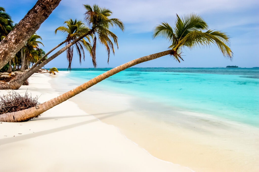
Planning a San Blas Islands guide adventure means discovering Panama’s pristine Caribbean paradise, where palm-fringed atolls meet turquoise waters and vibrant Guna Yala culture thrives. This archipelago of over 300 islands offers an off-the-grid escape unlike any other, and this San Blas Islands guide will help you navigate everything from cultural etiquette to hidden snorkeling spots before setting foot on these white sands.
Where Are the San Blas Islands?
Situated along Panama’s northeastern coast, the San Blas archipelago spans approximately 100 miles of the Caribbean Sea. The islands form part of the Guna Yala Comarca, a semi-autonomous territory governed by the Guna indigenous people. Unlike typical tourist destinations, this San Blas Islands guide highlights how visiting means stepping into a carefully preserved cultural zone where traditions remain strong centuries after European contact.
Geographic Highlights
The archipelago stretches from the Golfo de San Blas to the Colombian border, with the most visited islands clustered near the mainland. Key navigation points include the Cartí port (main departure point) and the Holandes Cays (home to famous "swimming pool" sandbars). The islands sit atop the Caribbean tectonic plate, resulting in shallow atolls perfect for snorkeling.
The Guna Yala People and Their Islands
The Guna people have stewarded these islands since their 1925 revolution against Panamanian government control. This San Blas Islands guide emphasizes how their unique governance system maintains language, customs, and environmental protection while allowing sustainable tourism:
Cultural Preservation in Action
Unlike other indigenous territories, the Guna actively restrict foreign ownership (only 3% of islands permit tourism development). Visitors witness living traditions like ulu (communal work days) and the intricate mola textile artistry. Each of the 49 occupied islands follows the same leadership structure: Sailas (chief), Argars (spiritual leaders), and voceros (interpreters) who enforce traditional laws.
- Traditional mola textiles adorn clothing and souvenirs, with authentic pieces taking 30-60 hours to create
- Thatched-roof bamboo cabins (called tambos) use no nails and can be dismantled for relocation
- Fishing follows lunar cycles, with hand-line techniques unchanged for generations
- Consensus-driven governance requires approval from all 49 community congresses for major decisions
What to Expect from the Islands
Though hundreds of islands exist in the chain, only about 50 are inhabited. This San Blas Islands guide details what makes them unique compared to destinations like Bocas del Toro or the Cayman Islands:
Island Classifications
The archipelago contains three main types of islands: coral atolls (like Cayos Holandeses), mainland-facing islands (such as Isla Aguja), and outer cays (including Dog Island). Coconut palms dominate most vegetation, with average island sizes around 0.5-2 acres. Unlike resort islands, you won't find swimming pools - nature provides perfect aquamarine "pools" between sandbars at low tide.
- Seclusion: Many islands like Yansailadup host fewer than 20 visitors at a time
- Natural beauty: Pristine coral reefs like those around Isla Perro showcase 120+ fish species
- Minimal infrastructure: Solar panels now supplement diesel generators on many islands
- Exploring multiple islands: Routes often include Robinson Crusoe-esque private islets for lunch stops
Getting to San Blas
A proper San Blas Islands guide must address the journey - an adventure that begins before you reach the water:
- 4x4 transfers traverse the 100km mountain route from Panama City in ~3 hours (including stops at the Guna checkpoint)
- Modern fiberglass pangas (versus traditional dugouts) make the 30-90 minute crossings to different island groups
- Custom itineraries can focus on eastern snorkeling spots or western cultural hubs like Narganá
For sailing tours en route to Colombia, catamarans typically spend 4 days exploring before the 30-hour open water crossing. Our Brief Guide to the San Blas Islands compares all transit options.
Exploring Multiple Islands
A multi-day San Blas Islands guide trip reveals why the journey matters as much as the destinations:
Sample 3-Day Itinerary
Day 1: Cartí port → Isla Perro (sunken ship snorkeling) → overnight at Yansailadup
Day 2: Natural pool sandbar → Isla Chichime (famous beach) → overnight at Coco Bandero
Day 3: Holandes Cays (heart-shaped reef) → return via Pelicano Island lunch stop
- Mornings: Wake to fishermen delivering the day’s lobster catch
- Midday: Swim through schools of sergeant majors and parrotfish
- Afternoons: Trade beads with Kuna women for molas
- Evenings: Learn Guna legends around a bonfire with fresh coconut rice
When to Visit
This San Blas Islands guide notes key seasonal differences compared to mainland Panama:
Microclimate Specifics
The archipelago has its own weather patterns due to offshore positioning. While December-May offers classic Caribbean weather, the "little summer" (September-October) provides optimal visibility for snorkeling São Blas wreck at Isla Perro. Note that Christmas/NYE rates jump 30-50% due to European demand.
- Dry season (Dec-Apr): Northeast trade winds create ideal sailing conditions
- Rainy season (May-Nov): Warmer waters (84°F/29°C) attract sea turtles
What Makes San Blas Unique
In this San Blas Islands guide, we contrast the experience with similar destinations:
Comparison to Other Island Groups
Unlike Jamaica’s all-inclusives or the Bahamas’ cruise ports, San Blas maintains an authenticity comparable only to places like Nicaragua’s Corn Islands - but with better reefs. The Guna’s cultural protection creates a "living museum" effect - watching women apply geometrical nose paint (ninpolli) or hearing elders debate in Tule language transports you centuries back.
- Cultural immersion: Participate in chicha fermentation demonstrations
- Sustainability: Plastic bottle recycling initiatives on 90% of tourist islands
- Authenticity: No ATMs, no chain restaurants, no watered-down cultural performances
- Accessibility: From Panama City to paradise in under 4 hours
Frequently Asked Questions
Where are the San Blas Islands located?
The San Blas Islands are situated along Panama’s northeastern coast, spanning approximately 100 miles of the Caribbean Sea. They form part of the Guna Yala Comarca, a semi-autonomous territory.
Who governs the San Blas Islands?
The Guna indigenous people govern the San Blas Islands as part of the Guna Yala Comarca. Their unique governance system maintains language, customs, and environmental protection.
What types of islands are found in the San Blas archipelago?
The archipelago contains three main types of islands: coral atolls (like Cayos Holandeses), mainland-facing islands (such as Isla Aguja), and outer cays (including Dog Island).
How do visitors travel from Panama City to the San Blas Islands?
Visitors typically take 4x4 transfers from Panama City, traversing a 100km mountain route in about 3 hours. Then, modern fiberglass pangas provide 30-90 minute crossings to different island groups.
When is the best time to visit the San Blas Islands?
The dry season, from December to April, offers ideal sailing conditions. However, the 'little summer' in September-October provides optimal visibility for snorkeling due to calmer waters.
Ready to explore San Blas?
Discover untouched islands, turquoise waters, and an authentic Caribbean journey with San Blas Adventures.